
Google launches underwater Street View for select areas


-
Topics
-
-
Latest Update
-
247
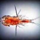
WTS live rotifers, tigger pods, phyto
Ups all available Tele me littlefishaqua -
-
10
WTS: JECOD DMP-40M Wavemaker x 2
Bump! Sent from my 2201123G using Tapatalk -
0
Selling Berghia Nudibranch (aiptasia cure)
Tank bred so very stable and hardworking creatures! Selling them in packs 3 for $150 5 for $200 -
6
WTS various corals at good prices.
Update of the leftover corals + new batch of big Bali Slimer which I have had for years. All corals clearing at good price. WA me at 96nineone03oneeight if keen. Collection at Geylang S398412. Thx!
-


Recommended Posts
Join the conversation
You can post now and register later. If you have an account, sign in now to post with your account.